|
Please subscribe to our channel here to get notification as soon as new videos are uploaded.  India is located in the North-Eastern Hemisphere. India is located in the North-Eastern Hemisphere. If you look at the map of the world, area north of equator is known as northern hemisphere and the area south of equator is known as southern hemisphere and area east of prime meridian is known as eastern hemisphere. In this way, we can say that India is located in the North-Eastern Hemisphere. 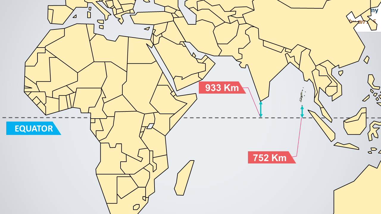 Distance of India from equator Distance of India from equator Distance of mainland India from equator is 933 Km and from Andaman and Nicobar, equator is 752 Km away. Latitude of India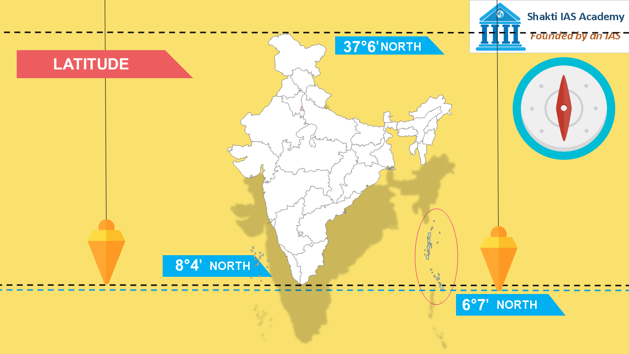 The Latitudinal Extent of India The Latitudinal Extent of India The latitudinal extent of mainland India is from 8° 4′ to 37° 6′ and if you measure the latitudinal extent of India from Andaman and Nicobar islands, it starts from 6° 7′ . Longitude of India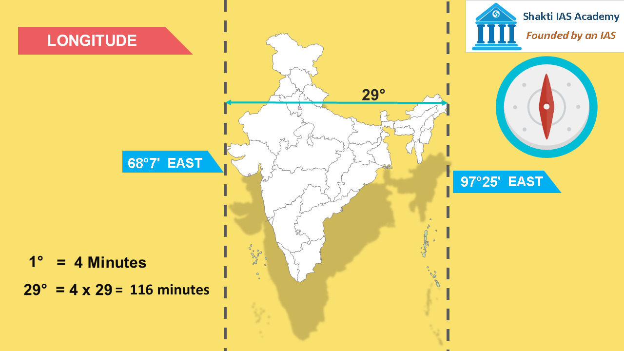 The Longitudinal Extent of India The Longitudinal Extent of India The longitudinal extent of India is from 68° 7′ to 97° 25′. So the difference between east to west is of 29° of longitudes. As you know, 1° of longitude makes a difference of 4 minutes, 29° degrees of longitude will make a difference of 116 minutes. Time Difference in India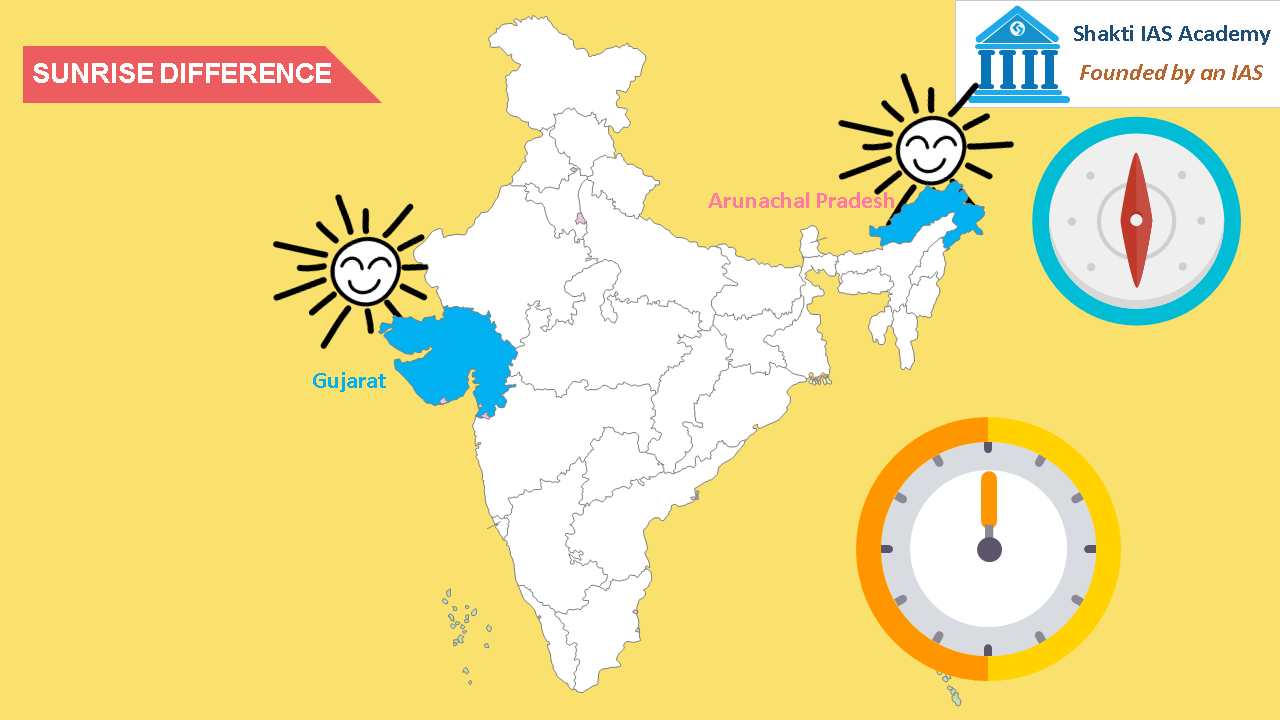 The Time difference between Arunachal Pradesh and Gujarat The Time difference between Arunachal Pradesh and Gujarat It means if there is sunrise at 4 am in Arunachal Pradesh, the sunrise in Gujarat will occur at around 6 am. Indian Standard Meridian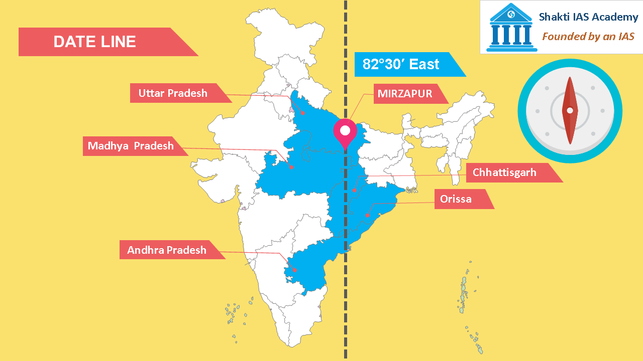 Indian Standard Time Indian Standard Time 82° 30′ is the Indian Standard Date Line, it passes through Mirzapur in Uttar Pradesh and touches five states of India. The states it passes through are Uttar Pradesh, Madhya Pradesh, Chhattisgarh, Orissa and Andhra Pradesh. Greenwich Mean Time and Indian Standard Time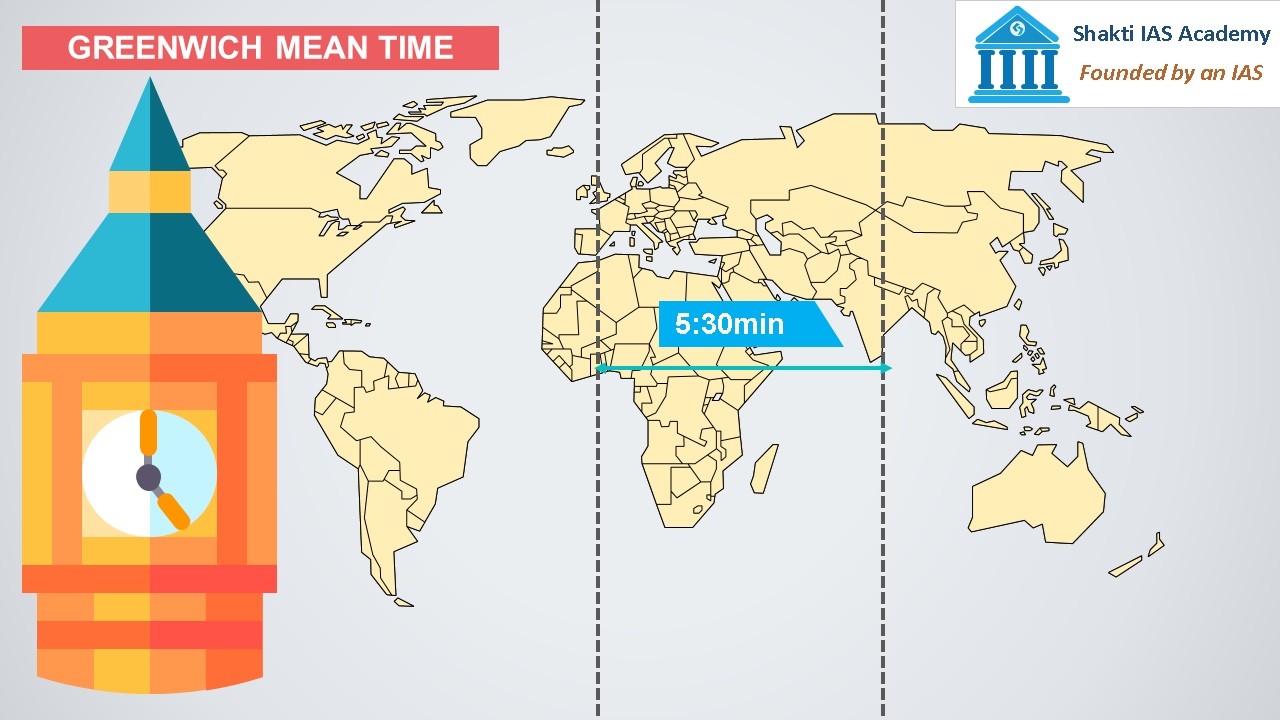 Difference between Indian standard time and Greenwich Mean Time Difference between Indian standard time and Greenwich Mean Time Indian Standard Date Line is 5 hours and 30 minutes ahead of Greenwich Mean Time. Tropic of Cancer Passing States in India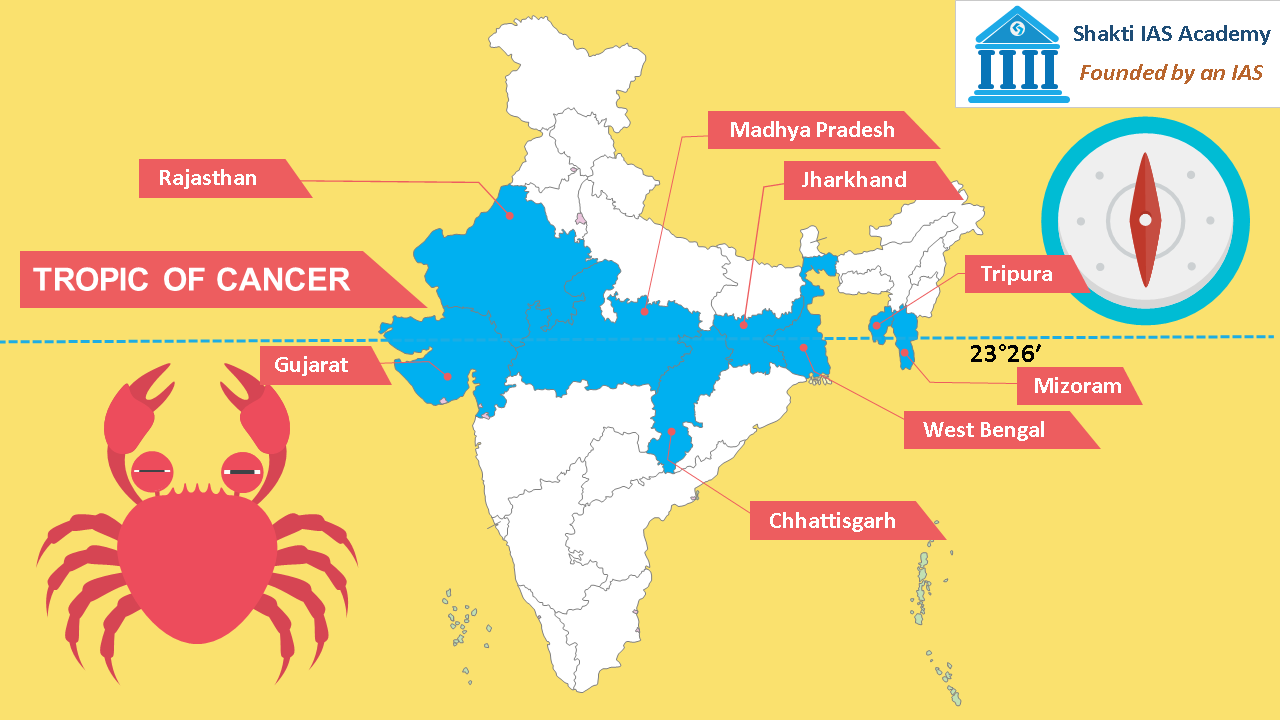 Tropic of Cancer passing states in India Tropic of Cancer passing states in India Tropic of Cancer passes through 8 states of India, the states it passes through are Gujarat, Rajasthan, Madhya Pradesh, Chhattisgarh, Jharkhand, West Bengal, Tripura and Mizoram. 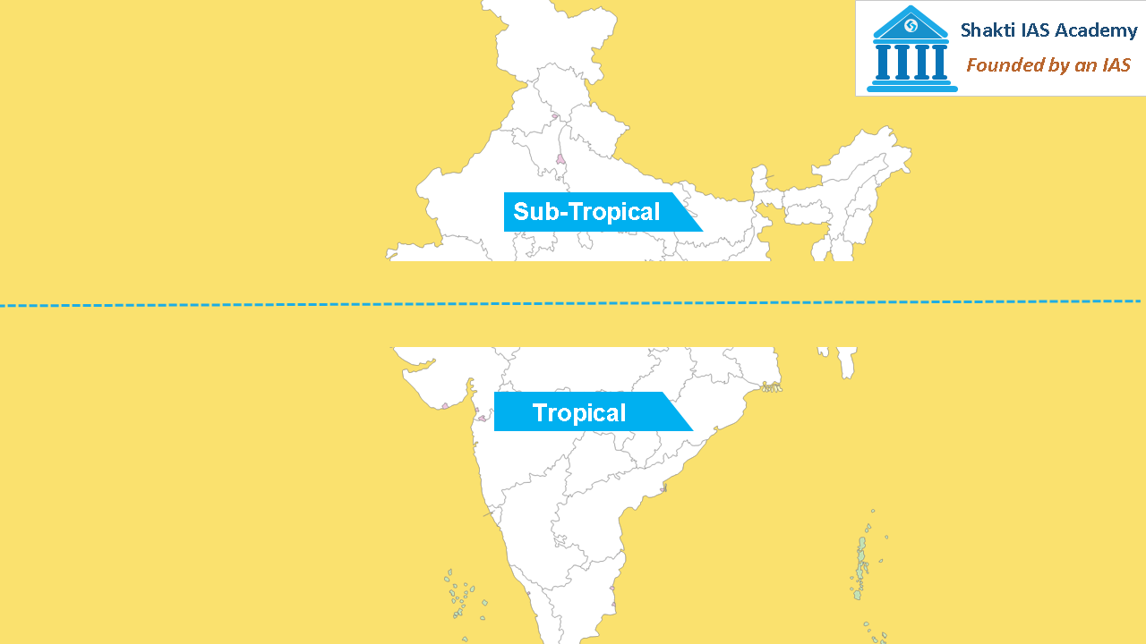 Tropic of Cancer dividing India Tropic of Cancer dividing India Tropic of cancer divides India into Tropical and Sub-tropical climate zones. The area north of Tropic of Cancer is twice the area south of it. Antipode of India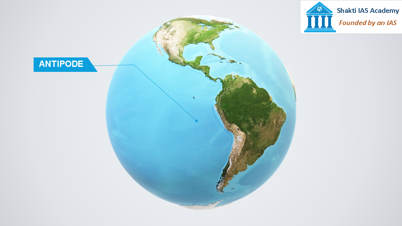 The Antipode of India The Antipode of India The antipode of India is located in the Pacific Ocean off the coast of Chile. But, what is antipode? Antipode is the direct opposite of something. Mean Sea Level of India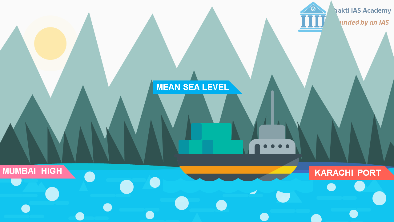 Mean Sea Level of India Mean Sea Level of India One more thing is also important to note that the mean sea level of India is measured at Mumbai High, before independence it was measured at Karachi port. Northernmost and Southernmost Point of India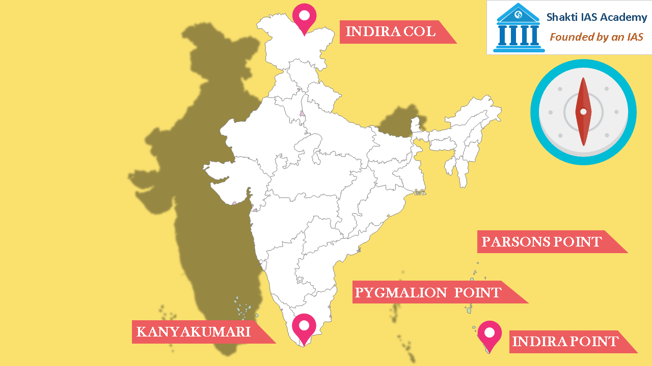 Indira Col, Kanyakumari and Indira Point Indira Col, Kanyakumari and Indira Point Northernmost point of India is Indira Col and the southernmost point of India is Indira Point. Indira Point was also known as Pygmalion Point or Parsons Point. Kanyakumari or Cape Comorin is the southernmost tip of mainland India. Length and Width of India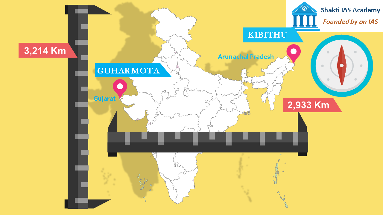 Distance of India from east to west Distance of India from east to west The distance from north to south of mainland India is 3,214 Km and from east to west is 2,933 Km. The easternmost point of India is Kibithu located in Arunachal Pradesh and the westernmost point is Guhar Mota located in Gujarat. Area of India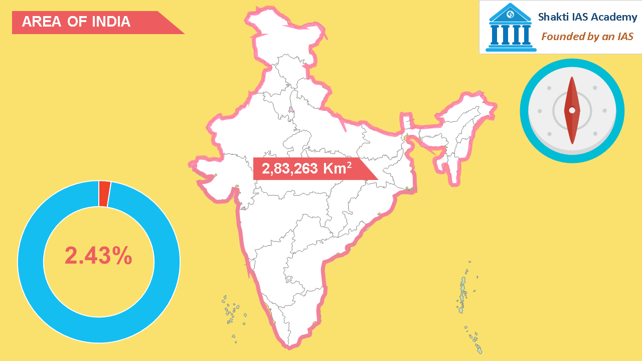 Area of India Area of India The are of India is 2,83,263 Km2 which is 2.43% of world surface area. 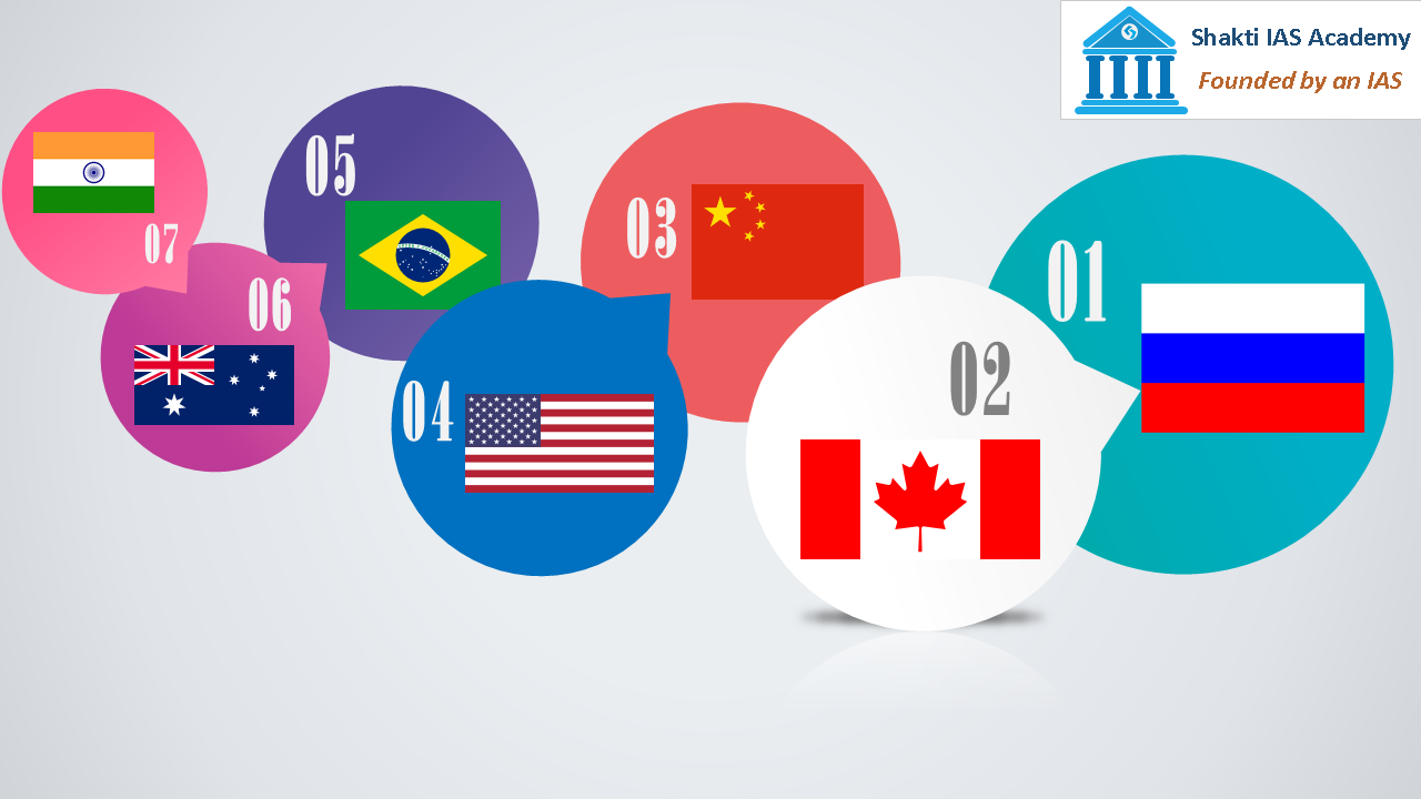 India seventh largest country by area India seventh largest country by area After Russia, Canada, China, America, Brazil, and Australia, India is the seventh largest country.  Composition of India's Surface Area Composition of India's Surface Area Out of total surface area of India, 10.7% is mountainous, 18.6% is hilly, 27.7% consist of plateaus and 43.0% is plain. Land and Water Frontiers of India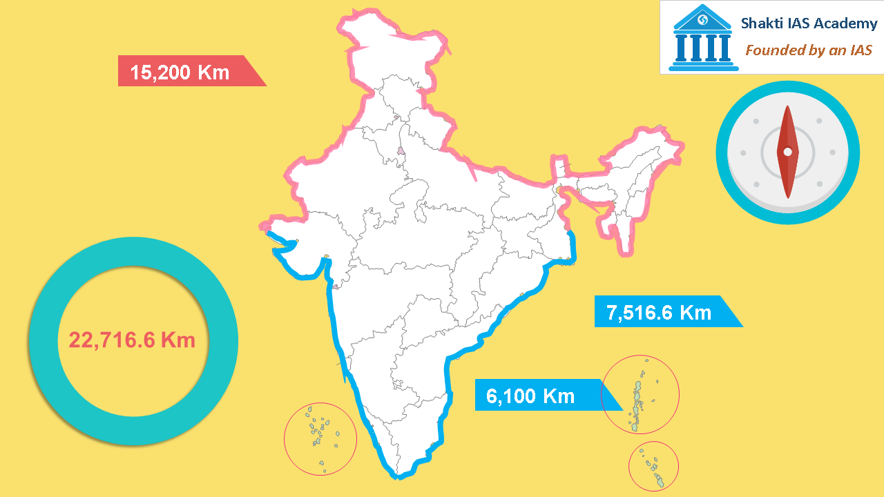 Total land and water frontiers of India Total land and water frontiers of India India has land frontier of 15,200 Km and water frontiers of mainland India is 6,100 Km. If we include water frontiers of islands of Andaman and Nicobar, Lakshadweep and other islands the total water frontiers add up to 7,516,6 Km. So, the total frontier of India is 22,716.6 Km. International Borders of India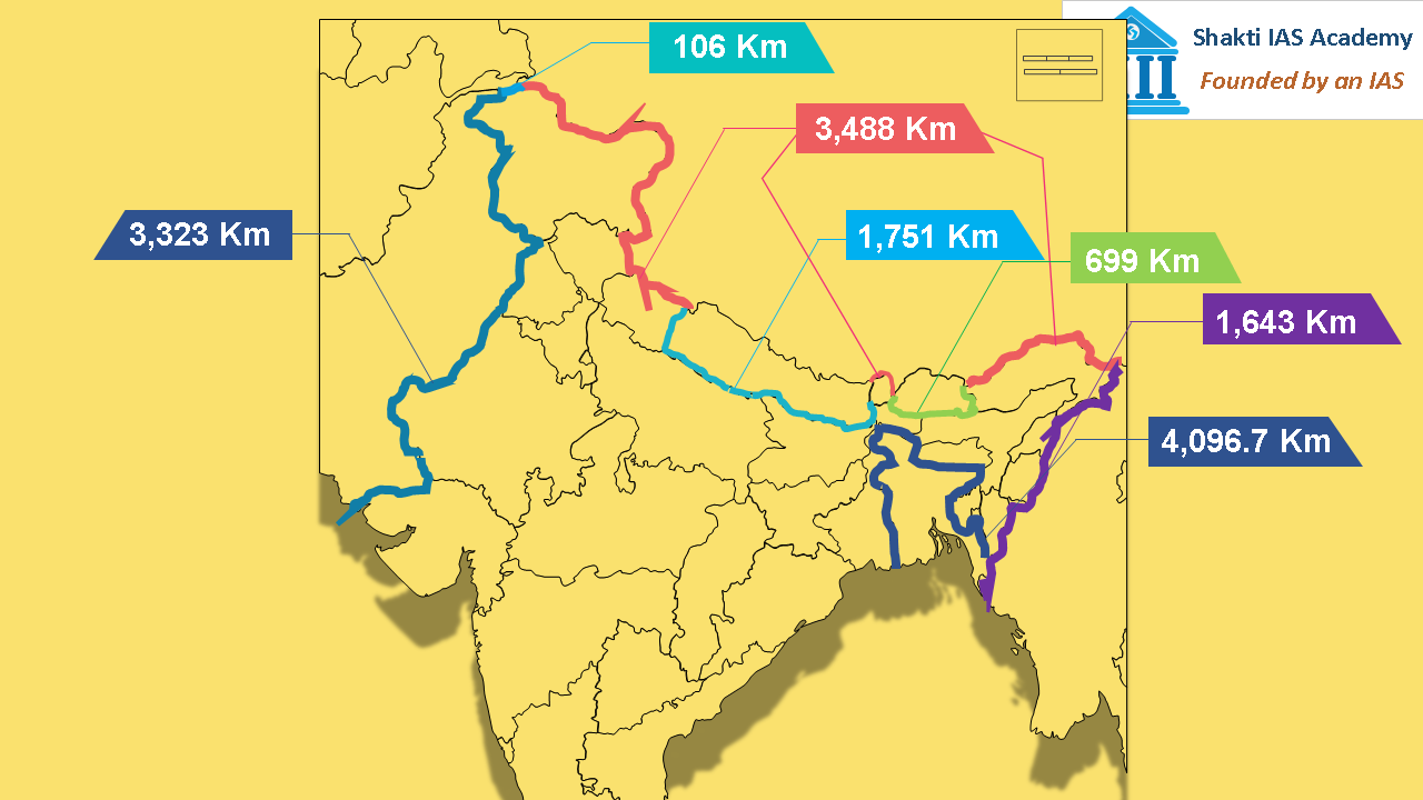 International borders of India International borders of India India’s international border touches with 7 countries. In descending order, India shares 4,096.7 Km border with Bangladesh, 3,488 Km with China, with Pakistan it shares 3,323 Km of border, with Nepal 1,751 Km, with Myanmar 1,643 Km of border, with Bhutan 699 Km, and with Afghanistan 106 Km of border.  John Radcliffe, Arthur McMahon, Henry Durand and Mr. Radoliff John Radcliffe, Arthur McMahon, Henry Durand and Mr. Radoliff Four people John Radcliffe, Arthur McMahon, Henry Durand and Mr. Radoliff played important role in demarcating the international boundary of India.  Radcliffe line, McMahon line,Durand Line,Radoliff line Radcliffe line, McMahon line,Durand Line,Radoliff line Radcliffe line demarcates the boundary between Pakistan and Punjab state of India, it was also the boundary line between Indian state of West Bengal and Bangladesh, McMahon line demarcates the boundary of Arunachal Pradesh with China. Durand Line is between Pakistan and Afghanistan and Radoliff line is between India and Nepal. 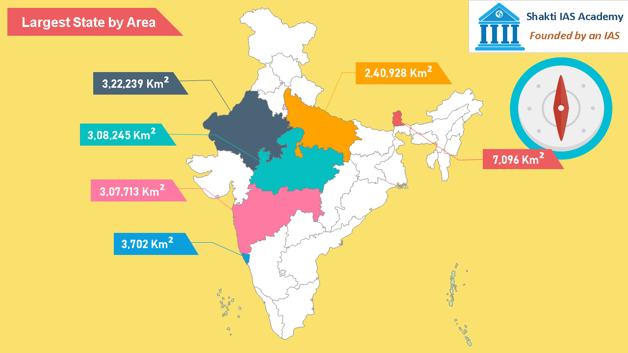 States with largest area in India States with largest area in India There are 29 states and 7 union territories in India. States with largest area in descending order are Rajasthan, Madhya Pradesh, Maharashtra and Uttar Pradesh. If we talk about the smallest state, Goa is smallest and then comes Sikkim. Uttar Pradesh shares it border with maximum number of states. All in all, it touches 8 states and 1 union territory. These states are Uttarakhand, Himachal Pradesh, Haryana, Madhya Pradesh, Chhattisgarh, Jharkhand, Bihar and the union territory of Delhi.If we talk about the international borders West Bengal, Sikkim, Arunachal Pradesh and Jammu & Kashmir touches the largest numbers of international borders than any other state of India. Union Territories of India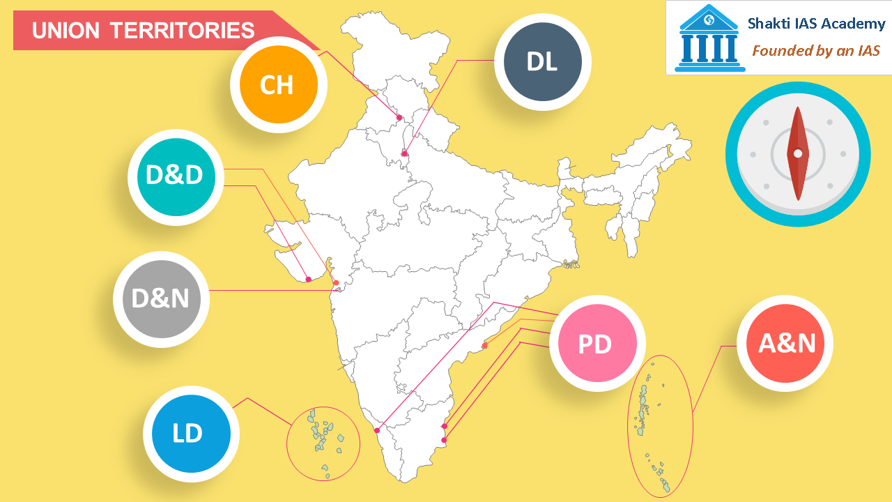 Union Territories in India Union Territories in India There are seven union territories in India – Andaman and Nicobar, Delhi, Puducherry, Dadra and Nagar Haveli, Chandigarh, Daman and Diu and Lakshadweep. 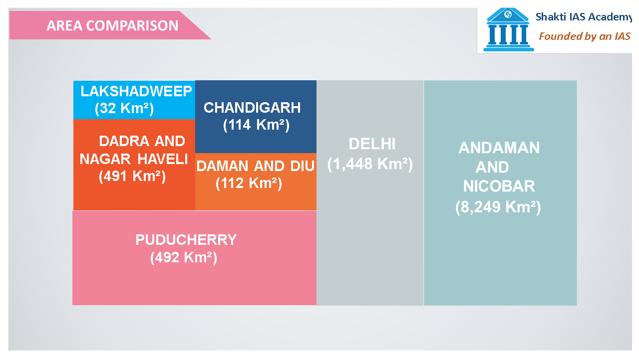 Areas of Union Territories of India Areas of Union Territories of India Lakshadweep is the smallest union territory with area of only 32 Km2 and Andaman and Nicobar is largest with area of 8,249 Km2. In terms of area, Delhi is on the second position, Puducherry on the third position, Dadra and Nagar Haveli fourth, Chandigarh fifth and Daman & Diu is on the sixth position.  10° Channel, Duncan Passage, 8° Channel and 9° Channel 10° Channel, Duncan Passage, 8° Channel and 9° Channel 10° channel separates Andaman & Nicobar island, Duncan passage lies between South Andaman and Little Andaman. Minicoy is separated from rest of the Lakshadweep by 9° channel and 8° channel separates Minicoy from Maldives. Indonesia is closest to Andaman & Nicobar island than any other southeast country. It’s only 163 Km far from Nicobar island.  Population of India Population of India With 1.21 billion people, India is second most populous country after China. 17.5% of the world population lives in India. Out of 1.21 billion people 62.31 crores are males and 58.74 crores are females. 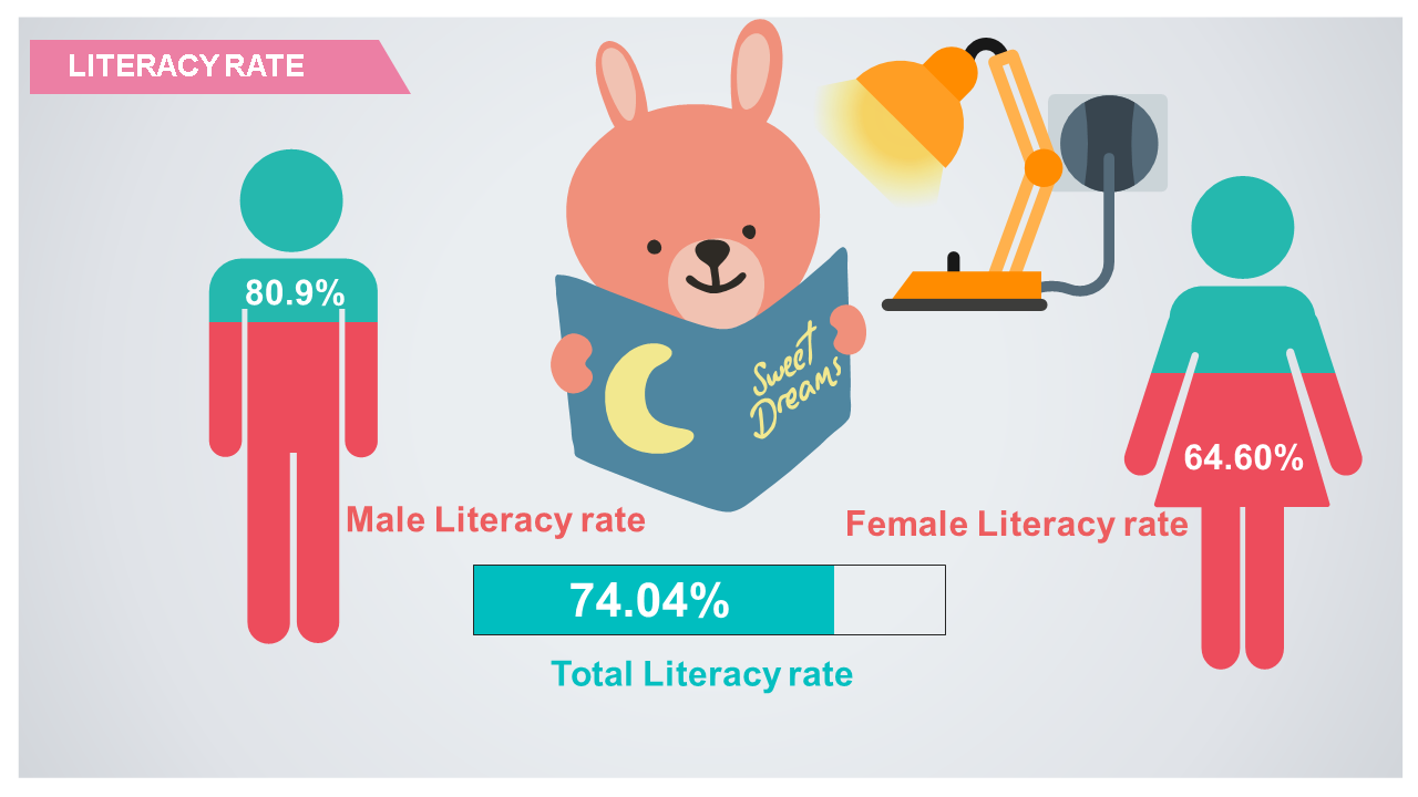 Literacy rate of India Literacy rate of India The decadal population growth rate of India is 17.7%. 31.2% population lives in the cities and 68.8% population lives in rural areas. The total literacy rate of India is 74.04% out of which male literacy rate is 80.9% and female literacy rate is 64.60%. 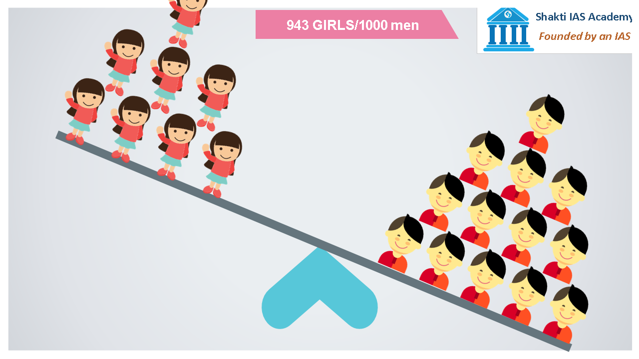 Sex ratio of India Sex ratio of India Sex ratio of India is 943 women per thousand men which means if 1000 men go out seeking brides 57 will never get a bride. In other words, 5.7% of the total male population in India will never get married. That’s whopping 3,55,17,945 men who will never get a bride. The population density of India is 382 person per square kilometre. 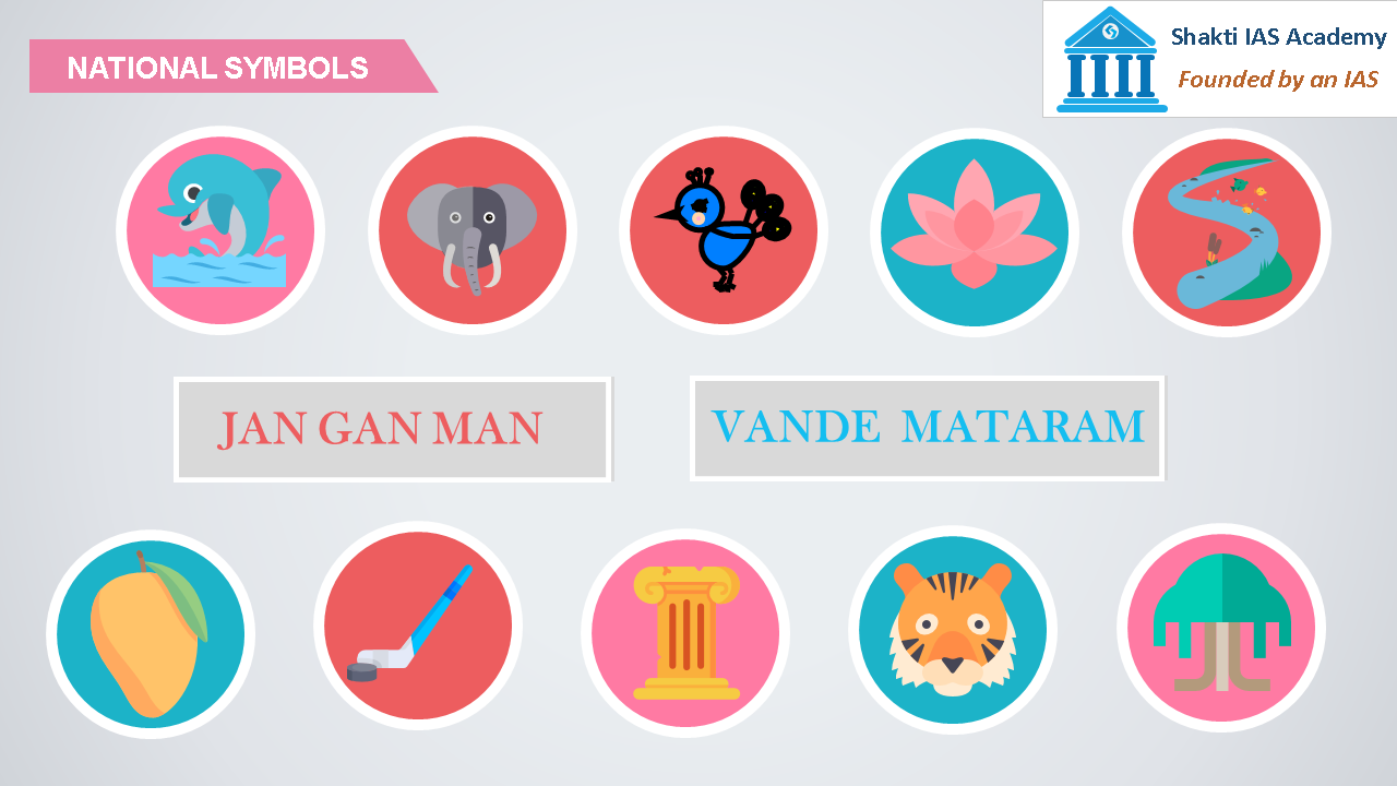 National Symbols of india National Symbols of india National animal of India is Bengal Tiger, national heritage animal of India is Elephant, national bird is peacock, national tree is Banyan Tree, national flower is Lotus, national emblem is Ashoka Pillar, national anthem is Jan Gan Man, national song is Vande Maaram, national aquatic animal is Dolphin, national rive river is Ganges, national fruit is Mango and national game is Hockey. Comments are closed.
|
