|
Please subscribe to our channel here to get notification as soon as new videos are uploaded. In this article, we're going to learn about the passes of Himalyan mountains located in the states of Jammu & Kashmir, Himachal Pradesh, Uttrakhand, Sikkim and Arunachal Pradesh. 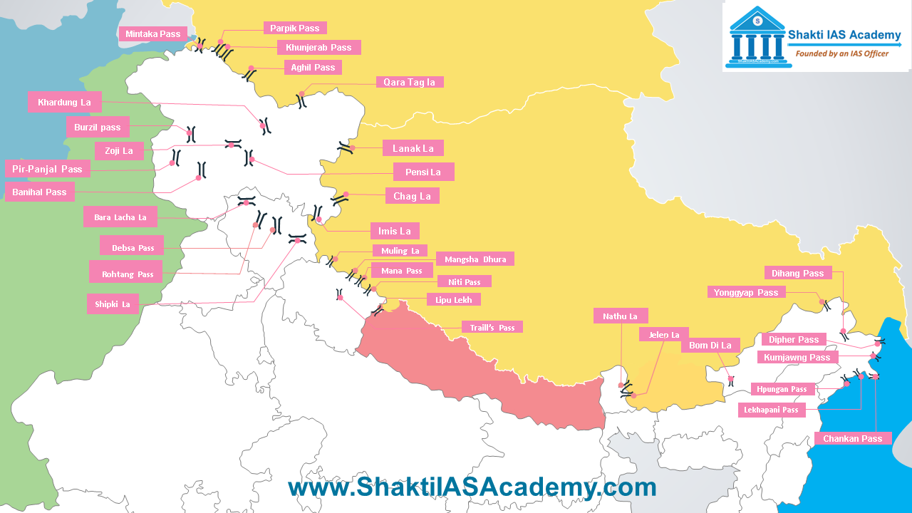 Passes of Himalayas Passes in Jammu & Kashmir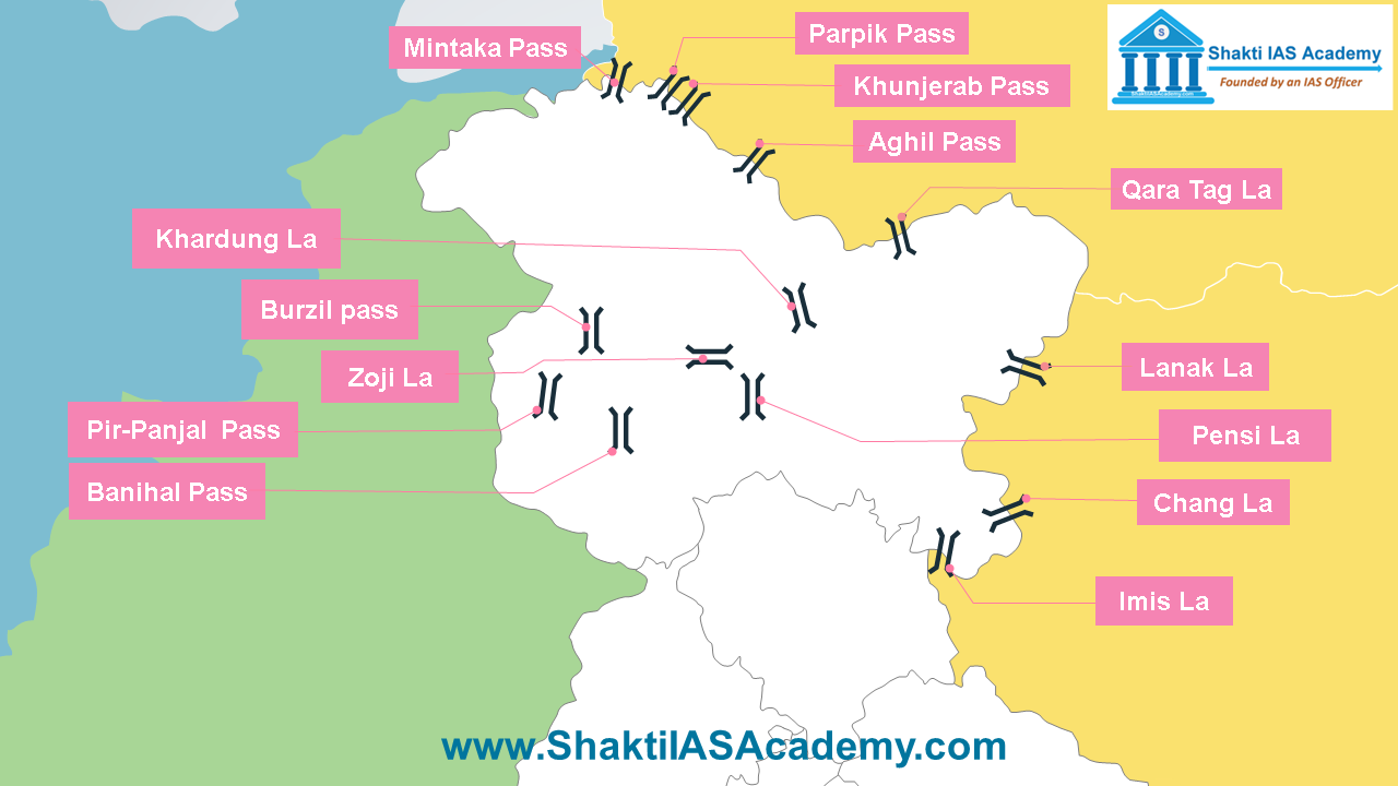 Mountain Passes in Jammu & Kashmir Mintaka Pass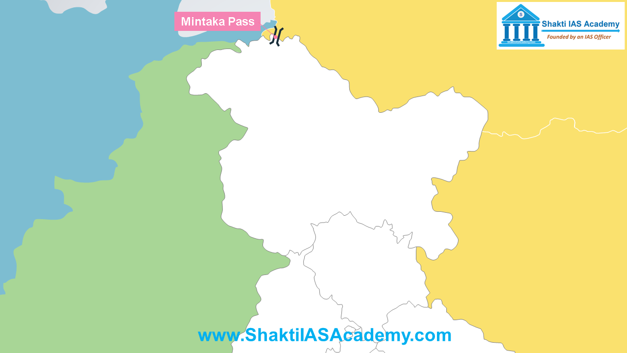 Mintaka Pass Mintaka Pass Mintaka means “thousand goats” in Kyrgyz language. Mintaka pass is located in the Karakoram range near the trijunction of India-China and Afghanistan border. Parpik Pass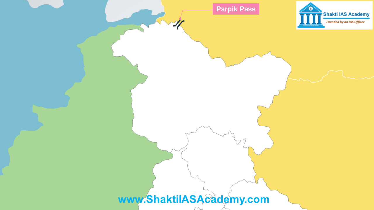 Parpik Pass Parpik Pass Parpik pass is located on the eastern side of the Mintaka pass and it joins Kashmir with China. Khunjerab Pass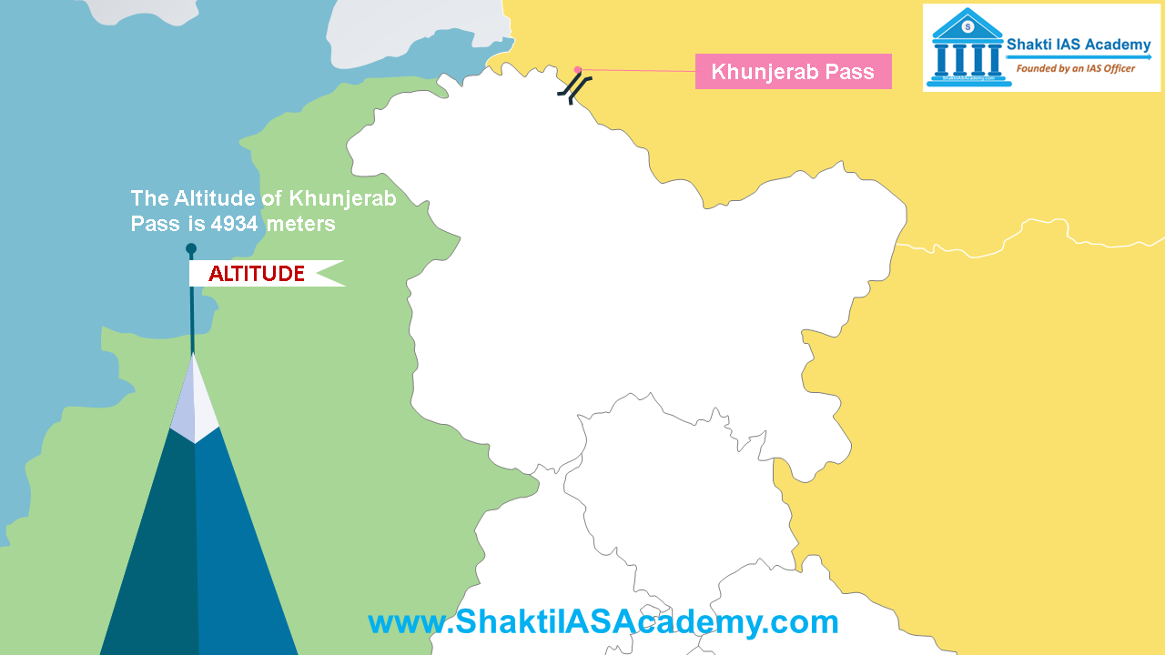 Khunjerab Pass Khunjerab Pass Altitude of Khunjerab Pass is 4934 meters. It's located just east of Parpik Pass. Banihal Pass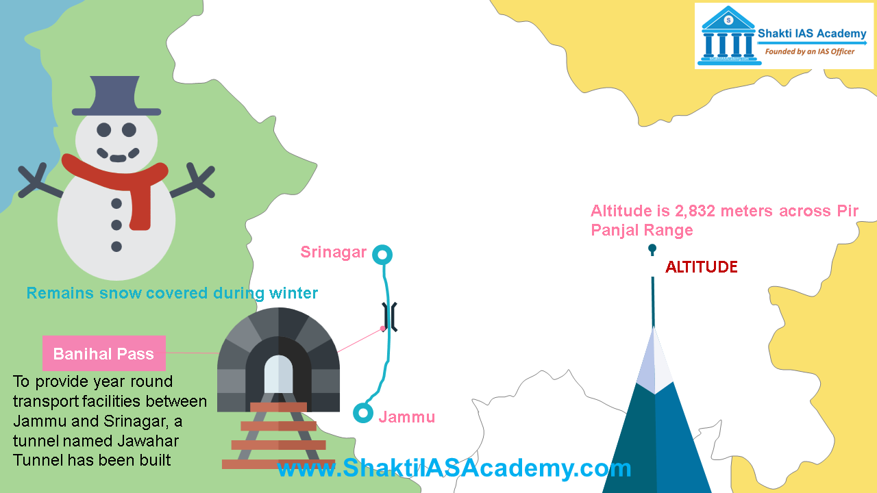 Banihal Pass Banihal Pass Banihal Pass is located at an altitude of 2832 meters across Pir Panjal Range. It remains snow covered during winter, to provide year round transport facilities between Jammu and Srinagar, a tunnel named Jawahar Tunnel has been created. Chang La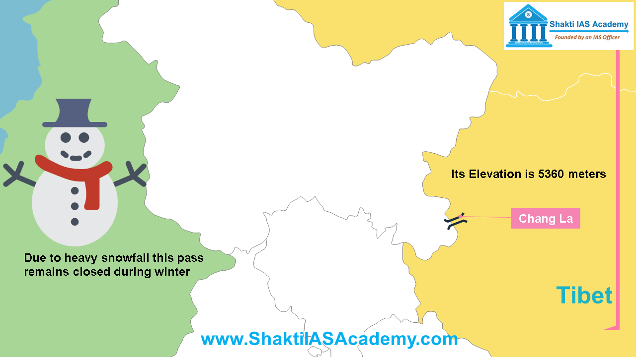 Chang La Chang La Chang La is located on Indo-China border and its elevation is 5360 meters. Due to heavy snowfall this pass remains closed during winter. Khardung La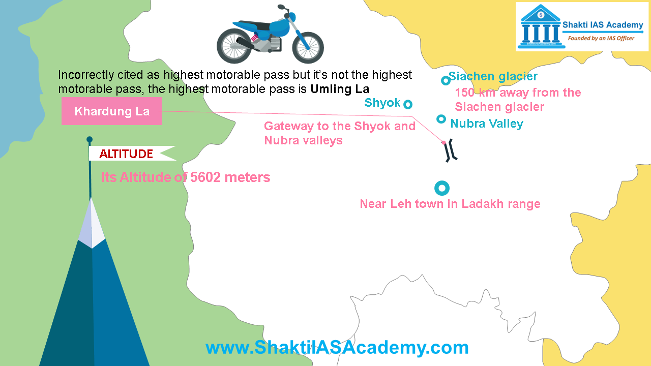 Khardung La Khardung La Khardung La is located at an altitude of 5602 meters near Leh town in Ladakh range and it is the gateway to the Shyok and Nubra valleys. It’s just 150 km away from the Siachen glacier. Strategically it is very important pass for India because it’s used to carry supplies to the Siachen Glacier. Khardung La is incorrectly cited as highest motorable pass but it’s not the highest motorable pass, the highest motorable pass is Umling La. Lanak La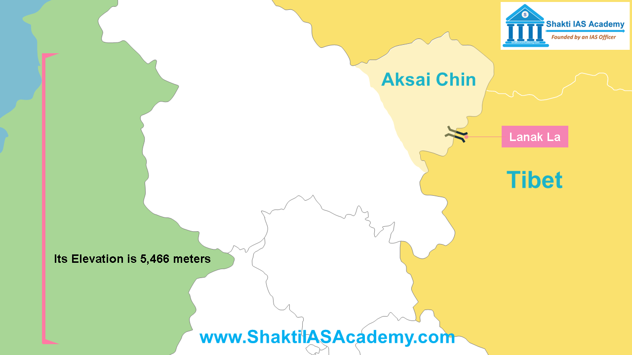 Lanak La Lanak La Lanak La is located in the disputed Aksai-Chin area of Jammu & Kashmir. Its elevation is 5,466 meters. Pir-Panjal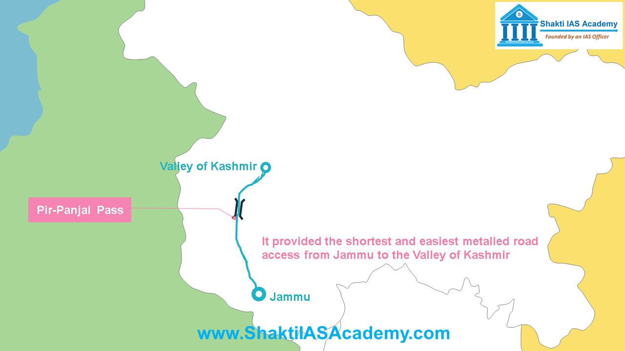 Pir Panjal Pass Pir Panjal Pass Pir-Panjal pass lies in Pir-Panjal range on Mughal road. After partition of the subcontinent, the pass was closed down. It provided the shortest and easiest metalled road access from Jammu to the Valley of Kashmir. Imis La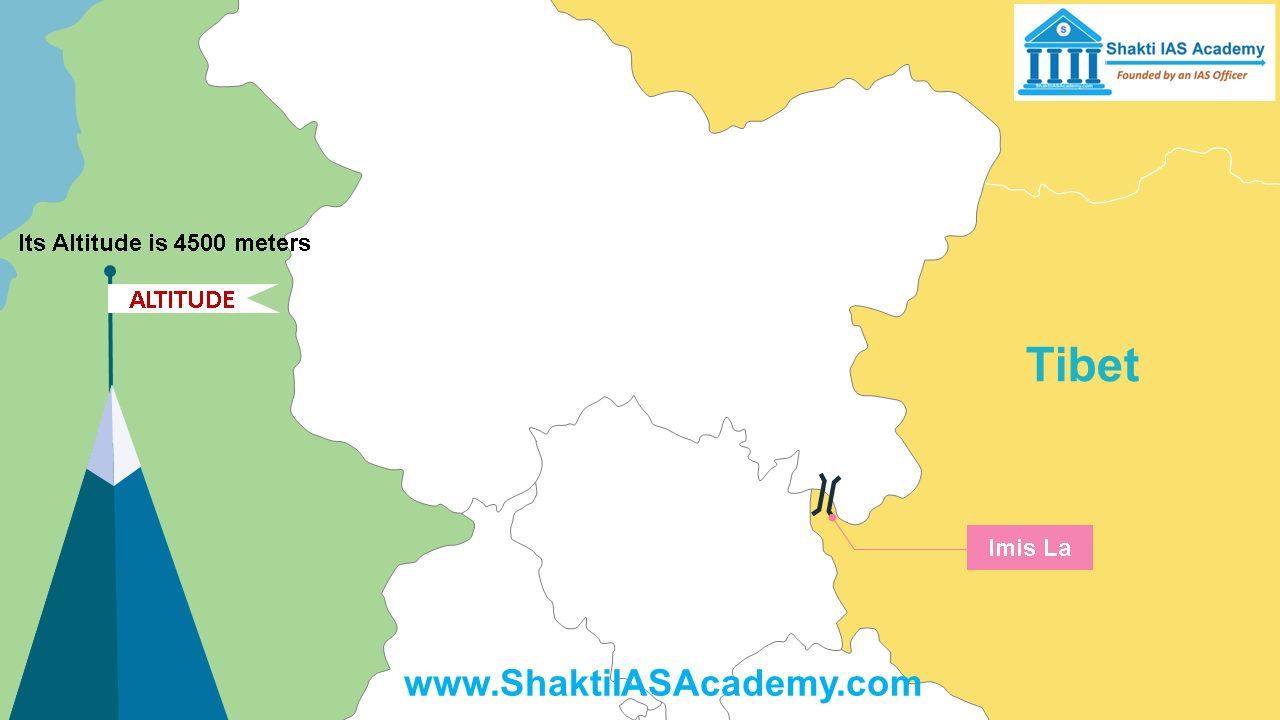 lmis La lmis La Imis La’s altitude is 4500 meters. It has very difficult terrain and steep slopes that’s why using this pass is not an easy task. Pensi La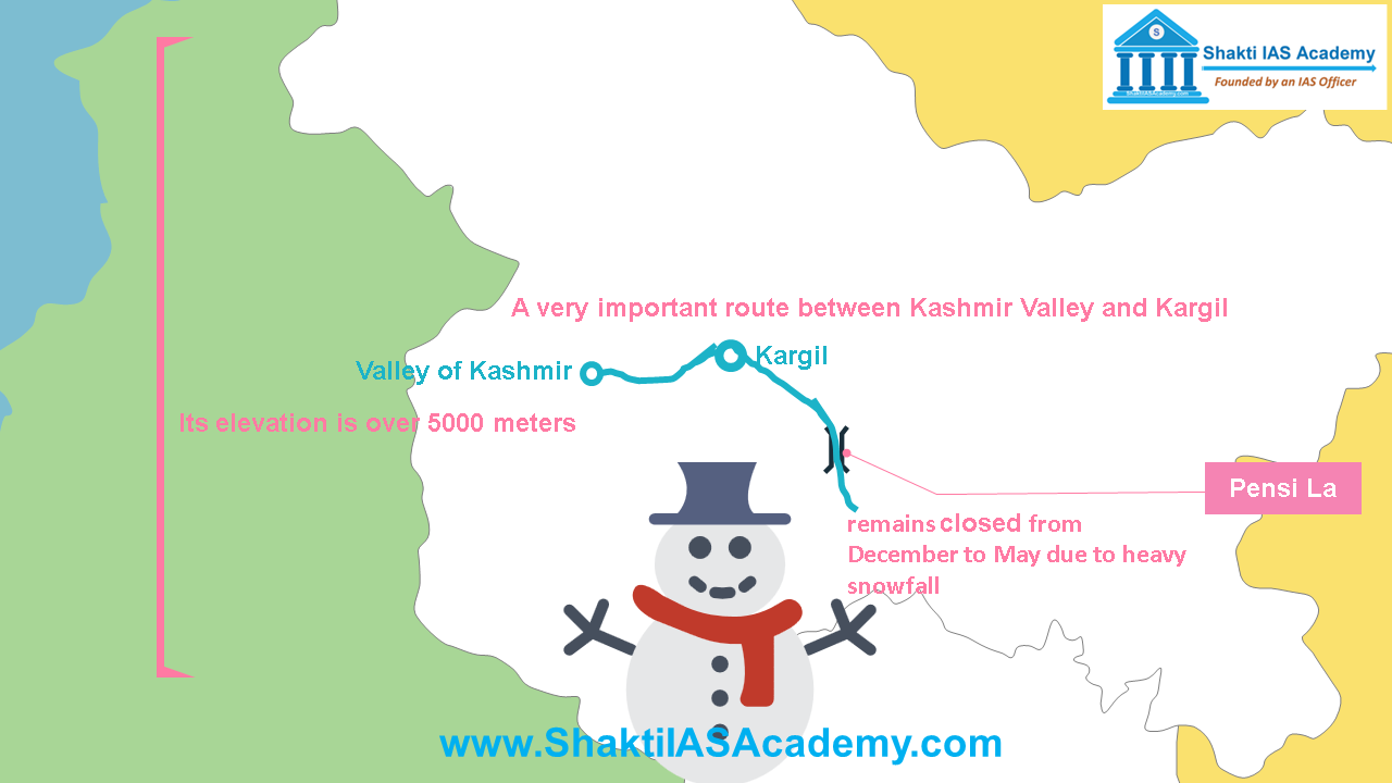 Pensi La Pensi La East of Zoji la is located Pensi La in Greater Himalayas. Its elevation is over 5000 meters. Pensi La is a very important route between Kashmir Valley and Kargil. It also remains closed from December to May due to heavy snowfall. Zoji La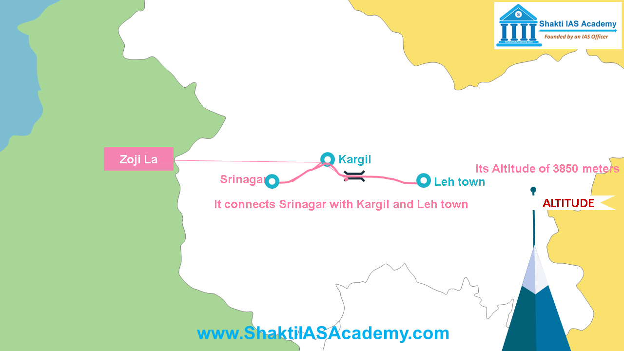 Zoji La Zoji La Zoji La is located at an altitude of 3850 meters. It connects Srinagar with Kargil and Leh town. This pass remains closed from December to May. Aghil Pass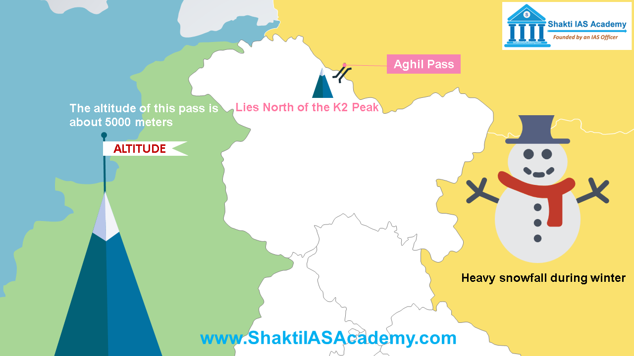 Aghil Pass Aghil Pass Aghil pass lies north of the K2 Peak, the altitude of this pass is about 5000 meters above sea level. It remains closed from November to May due to heavy snowfall during winter. Qara Tag La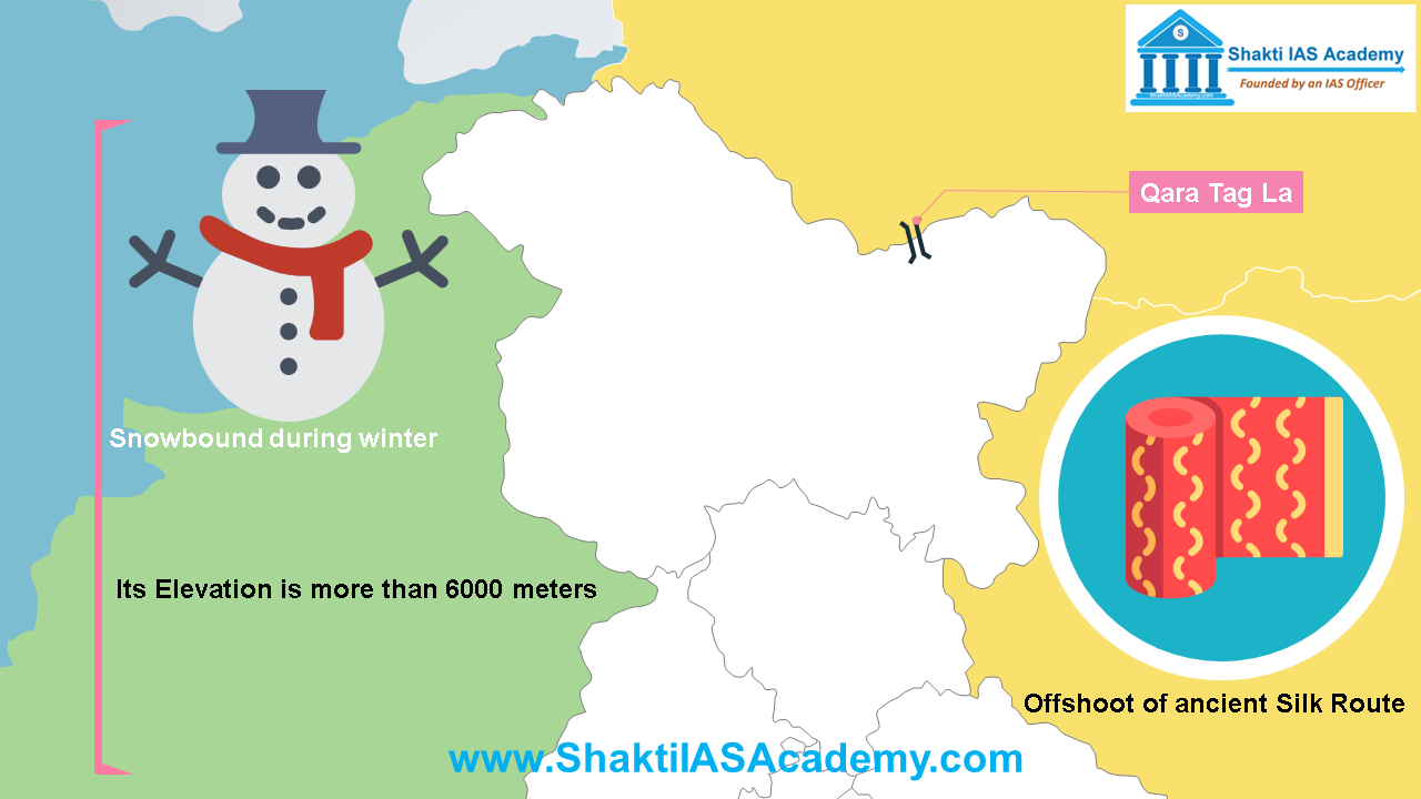 Qara Tag La Qara Tag La Qara Tag La is the offshoot of ancient Silk Route. It remains snowbound during winter because its elevation is more than 6000 meters. Burzil Pass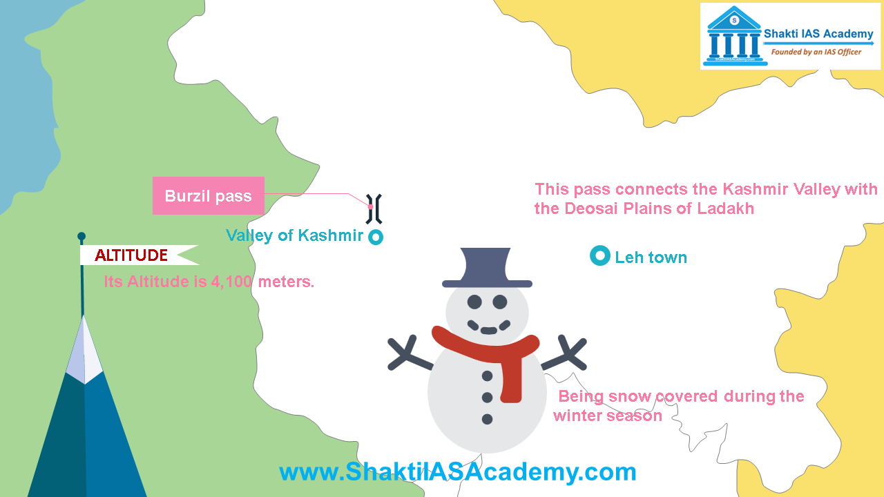 Burzil Pass Burzil Pass Burzil pass is situated at an altitude of 4,100 meters above sea level, this pass connects the Kashmir Valley with the Deosai Plains of Ladakh. Being snow covered during the winter season it remains closed for trade and transport. Passes of Himachal Pradesh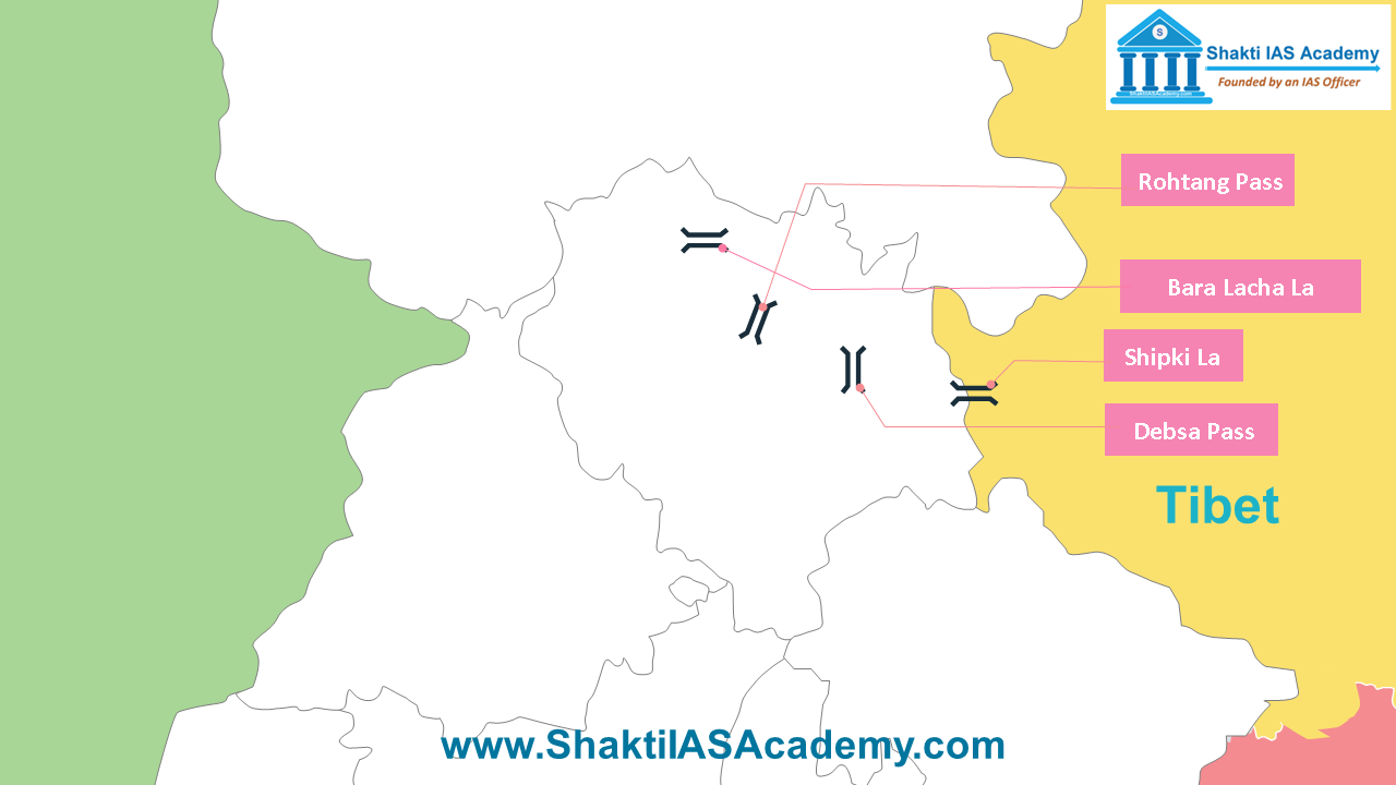 Passes of Himachal Pradesh Bara Lacha La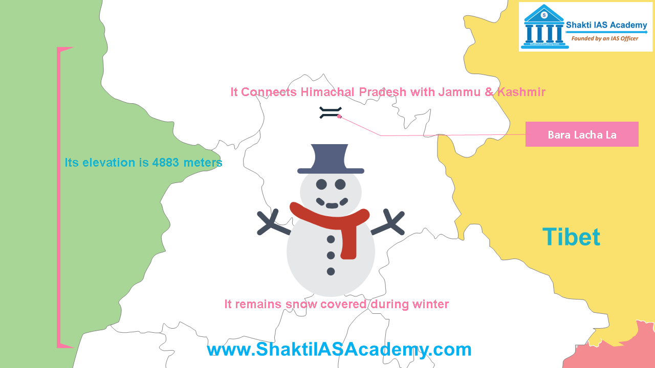 Bara Lacha La Bara Lacha La Bara Lacha La pass connects Himachal Pradesh with Jammu & Kashmir. Its elevation is 4883 meters. Due to high altitude, it remains snow covered during winter and can’t be used for transportation. Debsa Pass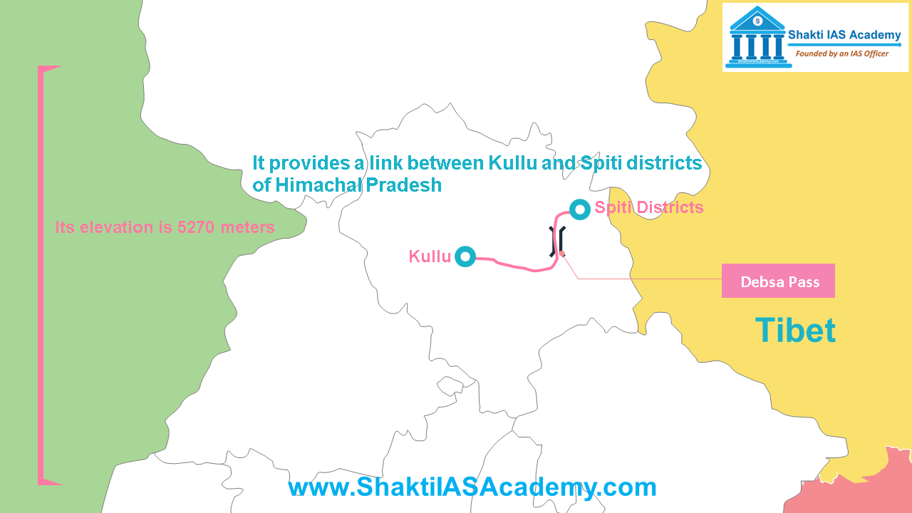 Debsa Pass Debsa Pass Debsa Pass, its elevation is 5270 meters and it’s located in the Greater Himalayas range. Debsa pass provides a link between Kullu and Spiti districts of Himachal Pradesh. Rohtang Pass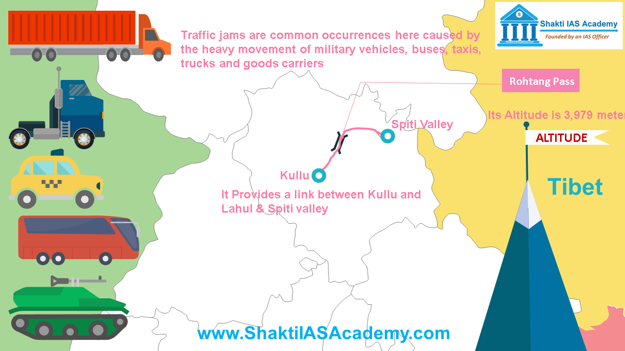 Rohtang Pass Rohtang Pass Rohtang Pass, it is located at an altitude of 3979 meters and provides a link between Kullu and Lahul & Spiti valley of Himachal Pradesh. Rohtang pass is tourist place and heavy traffic passes through this route. Traffic jams are common occurrences here caused by the heavy movement of military vehicles, buses, taxis, trucks and goods carriers. Shipki La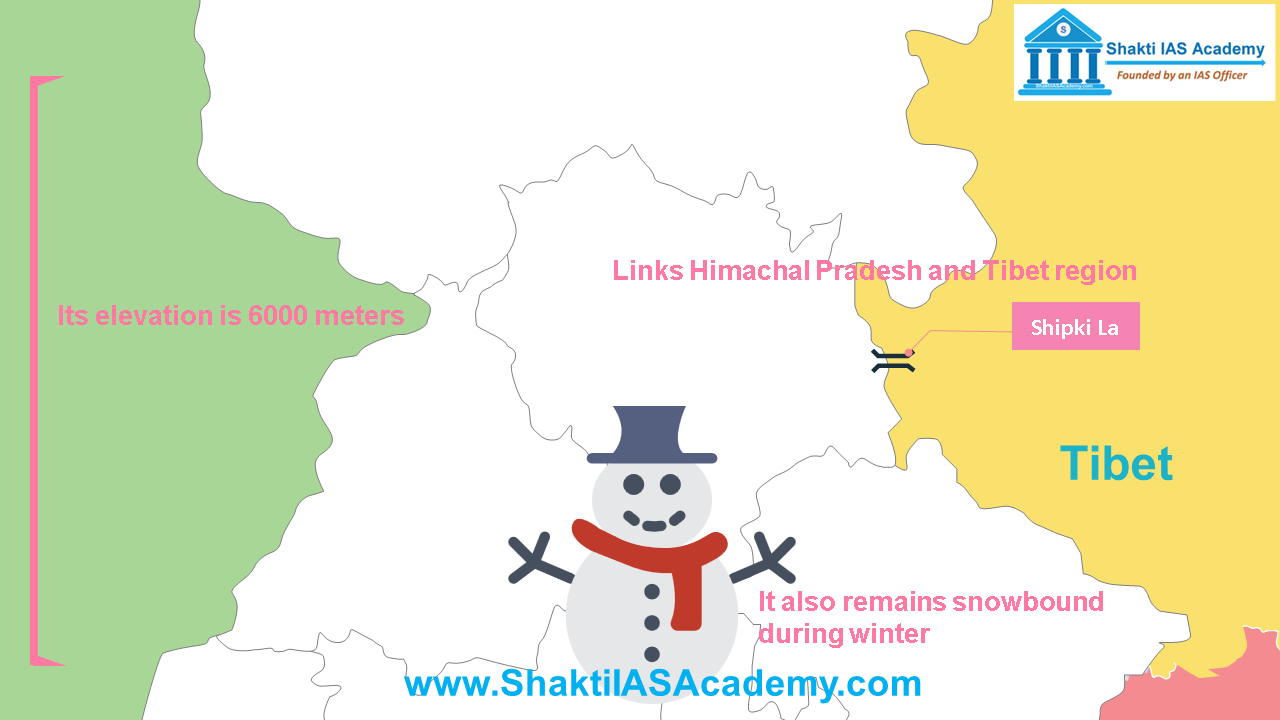 Shipki La Shipki La Shipki La is located on the Indo-China border and its elevation is 6000 meters. Shipki La passes through Jhelum Gorge and provides a road link between Himachal Pradesh and Tibet region. It also remains snowbound during winter. Passes of Uttrakhand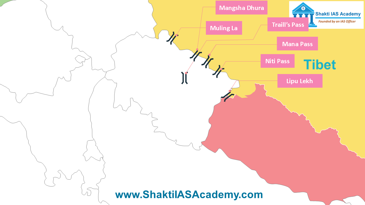 Passes of Uttarakhand Lipu Lekh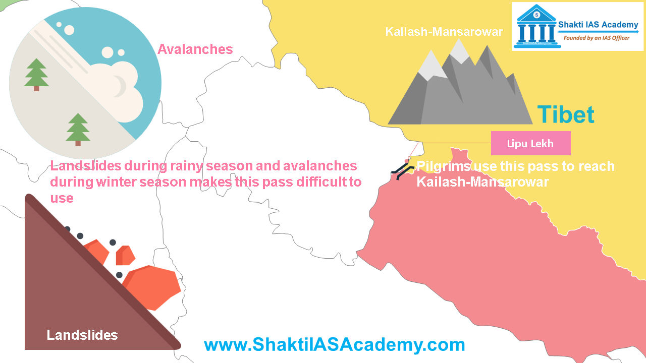 Lipu Lekh Lipu Lekh Lipu Lekh, it’s situated near the trijunction of India, Tibet and Nepal borders. Pilgrims use this pass to reach Kailash-Mansarowar. Landslides during rainy season and avalanches during winter season makes this pass difficult to use. Mana Pass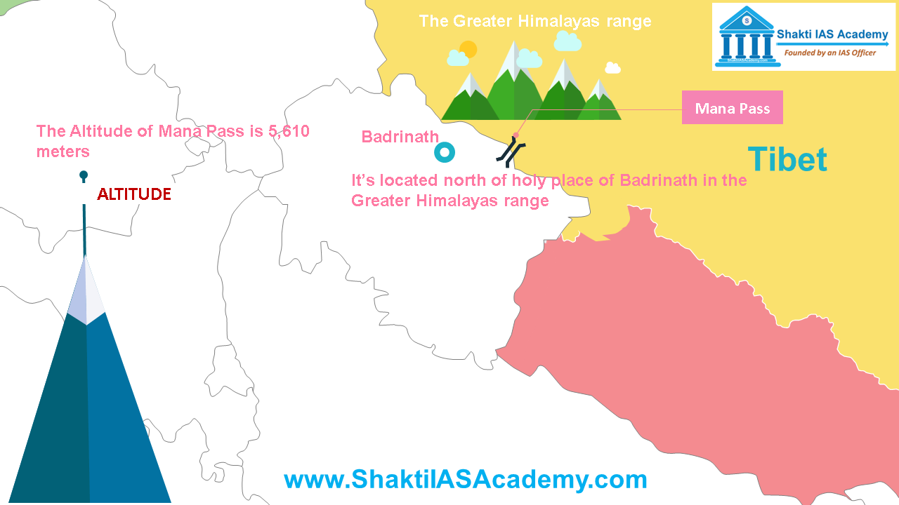 Mana Pass Mana Pass Mana Pass connects Uttarakhand with Tibet. It’s located north of holy place of Badrinath in the Greater Himalayas range. The altitude of Mana Pass is 5610 meters. Mangsha Dhura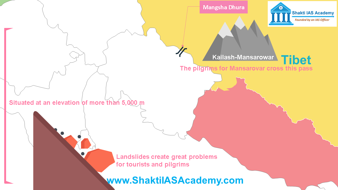 Mangsha Dhura Mangsha Dhura Mangsha Dhura situated at an elevation of more than 5,000 m, The pilgrims for Mansarovar cross this pass. Landslides create great problems for tourists and pilgrims. Niti Pass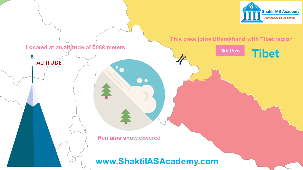 Niti Pass Niti Pass Niti Pass, located at an altitude of 5068 meters. This pass joins Uttarakhand with Tibet region. This pass remains snow covered from November to mid-May. Muling La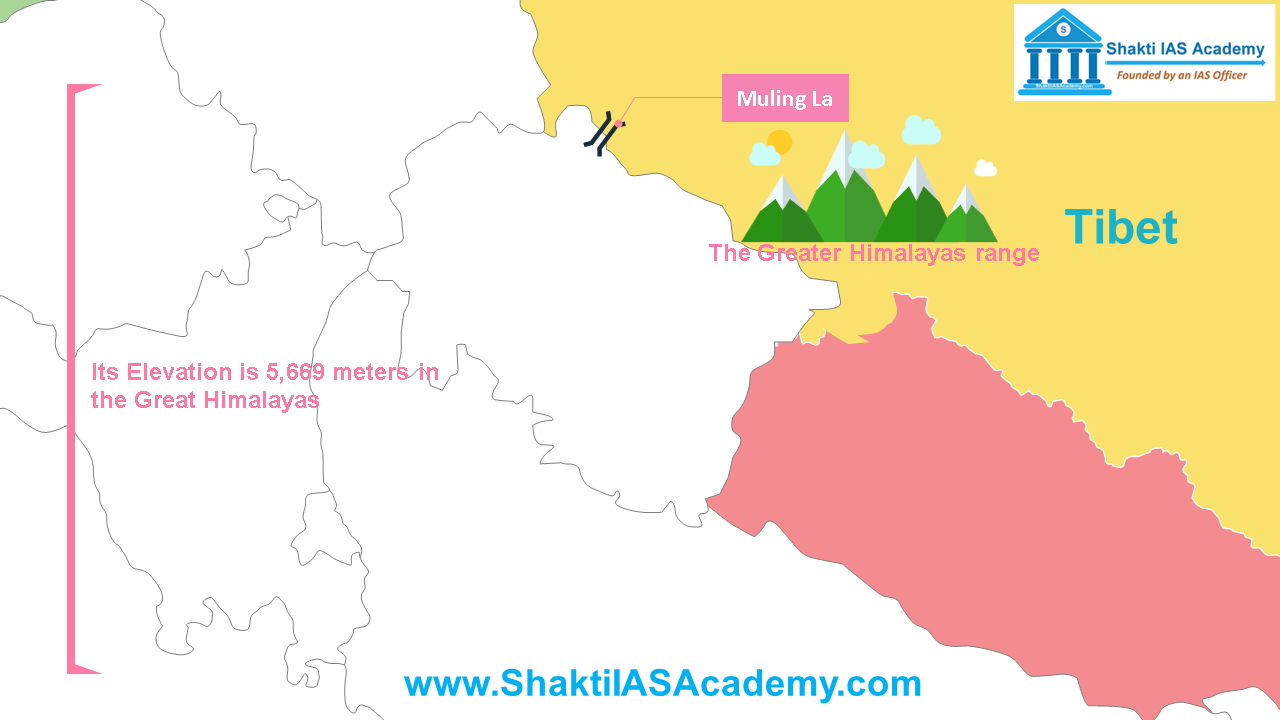 Muling La Muling La Muling La is situated north of Gangotri at an elevation of 5669 meters in the Great Himalayas. It also remains closed during winter. Traill’s Pass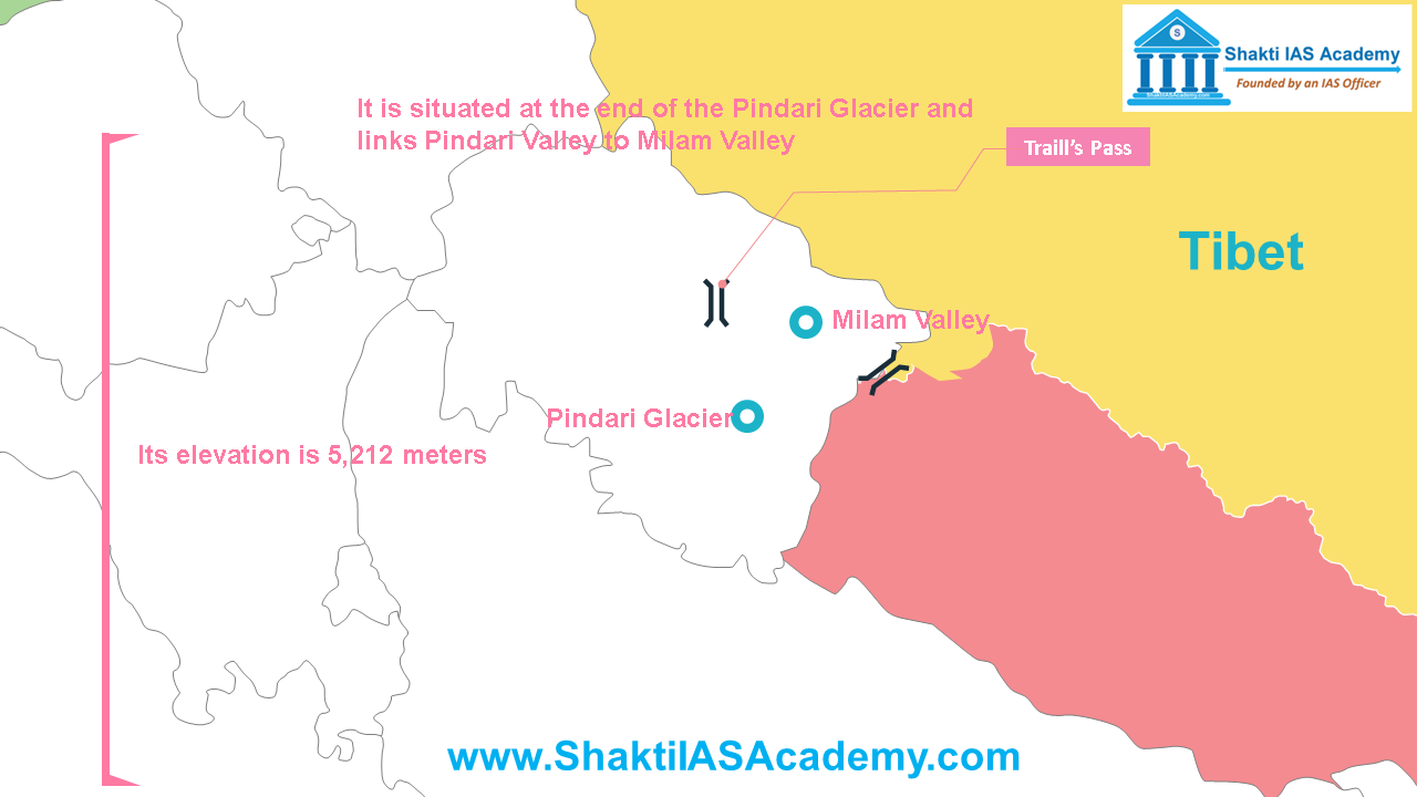 Traill's Pass Traill's Pass Traill’s Pass is located at an elevation of 5212 m above sea level, it is situated at the end of the Pindari Glacier and links Pindari Valley to Milam Valley. Being steep and rugged, this pass is very difficult to cross. Passes of Sikkim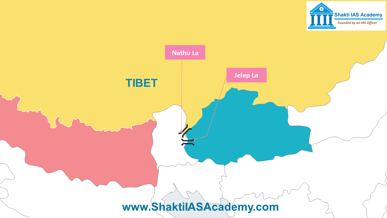 Passes of Sikkim Nathu La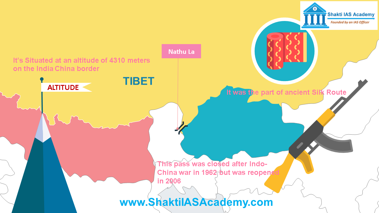 Nathu La Nathu La Nathu La is situated at an altitude of 4310 meters on the India China border. It was the part of ancient Silk Route. Nathu La connects Sikkim with Tibet region. This pass was closed after Indo-China war in 1962 but was reopened in 2006. Jelep La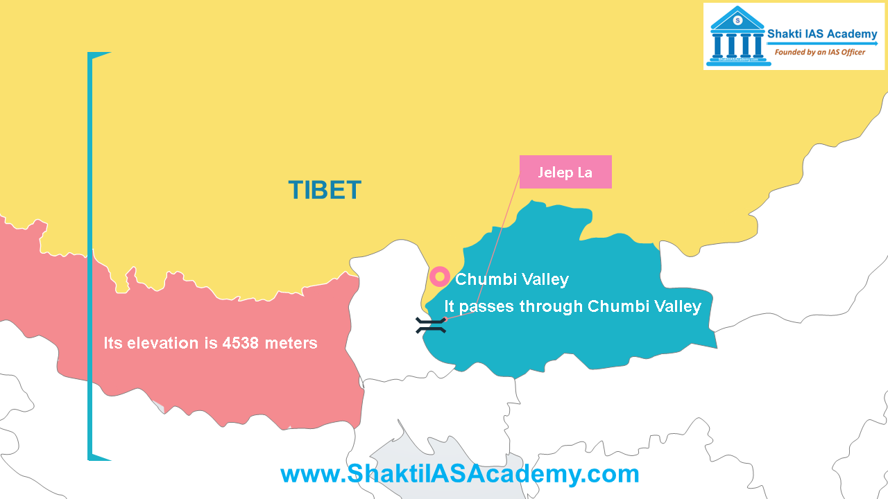 Jelep La Jelep La Jelep La lies at the Sikkim and Bhutan border. Its elevation is 4538 meters. It passes through Chumbi Valley. Jelep la provides a very important link between Sikkim and Lhasa. Passes of Arunachal Pradesh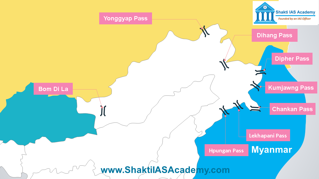 Passes of Arunachal Pradesh Bom Di La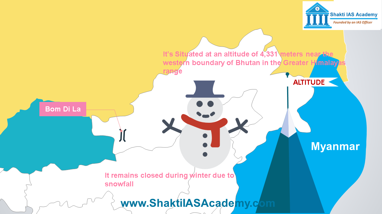 Bom Di La Bom Di La Bom Di La is situated at an altitude of 4331 meters near the western boundary of Bhutan in the Greater Himalayas range. Bom Di La connects Arunachal Pradesh with Lhasa. It remains closed during winter due to snowfall. Dihang Pass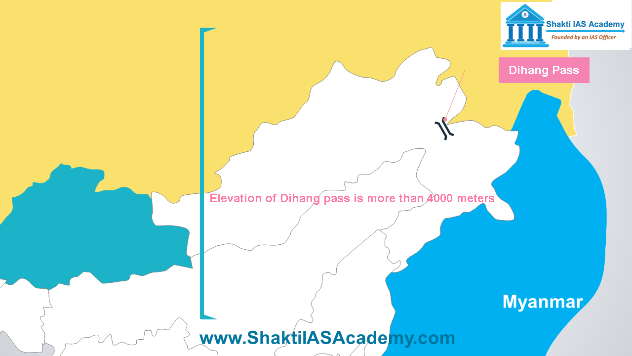 Dihang Pass Dihang Pass Elevation of Dihang pass is more than 4000 meters and it provides passage between Arunachal Pradesh. Dipher Pass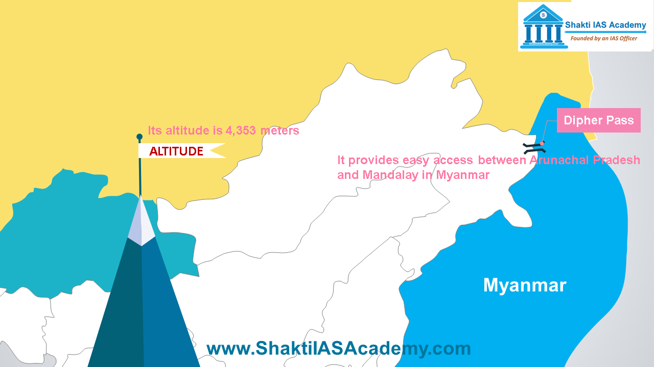 Dipher Pass Dipher Pass Dipher pass lies on the trijunction of India, China and Myanmar. Its altitude is 4353 meters. It provides easy access between Arunachal Pradesh and Mandalay in Myanmar. It’s an important trade route between India and Myanmar and remains open throughout the year. Yonggyap Pass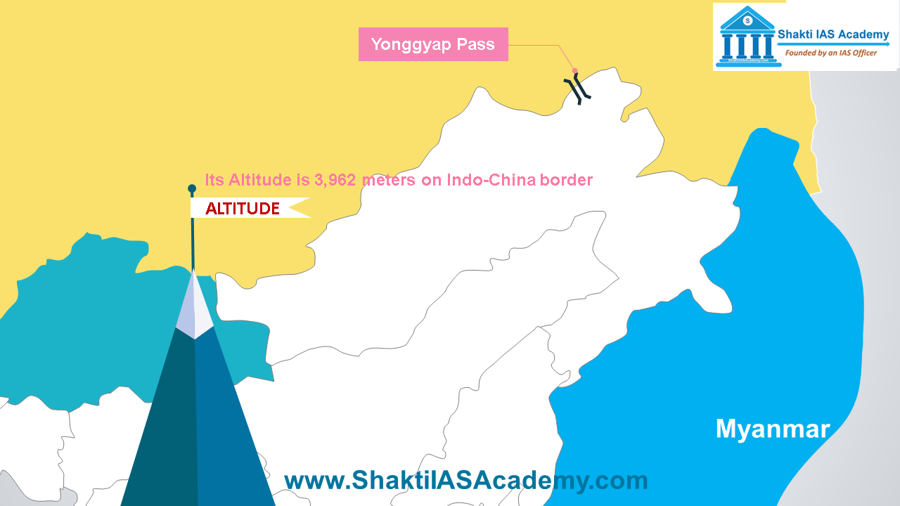 Yonggyap Pass Yonggyap Pass Yonggyap pass lies at an altitude of 3962 meters on Indo-China border and joins Arunachal Pradesh with Tibet region. Chankan Pass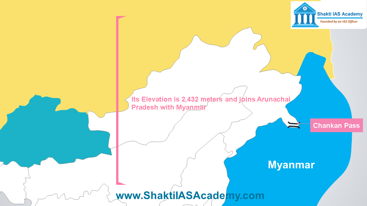 Chankan Pass Chankan Pass Chankan Pass also lies on the Indo-Myanmar border at an elevation of 2432 meters and joins Arunachal Pradesh with Myanmar. Kumjawng Pass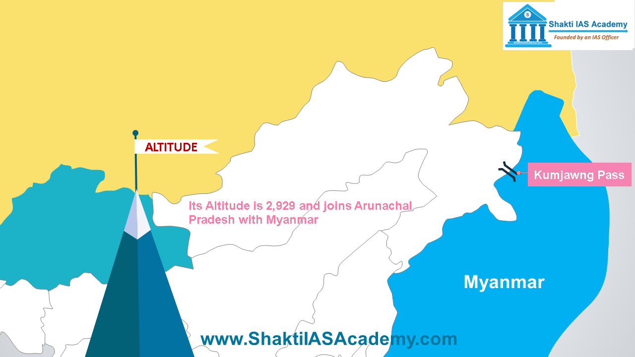 Kumjawng Pass Kumjawng Pass Kumjawng Pass also lies on Indo-Myanmar border at an altitude of 2929 and joins Arunachal Pradesh with Myanmar. Hpungan Pass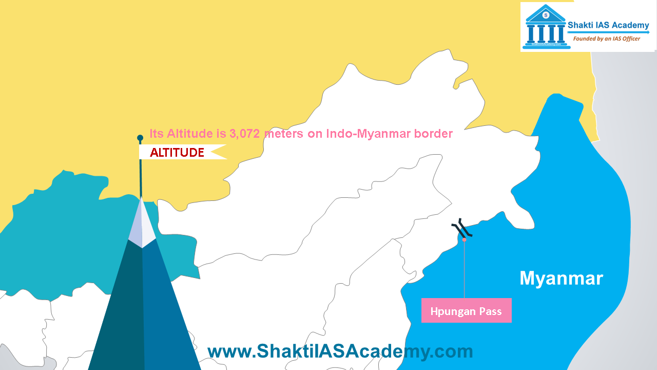 Hpungan Pass Hpungan Pass Hpungan Pass lies at an altitude of 3072 meters on Indo-Myanmar border. Lekhapani Pass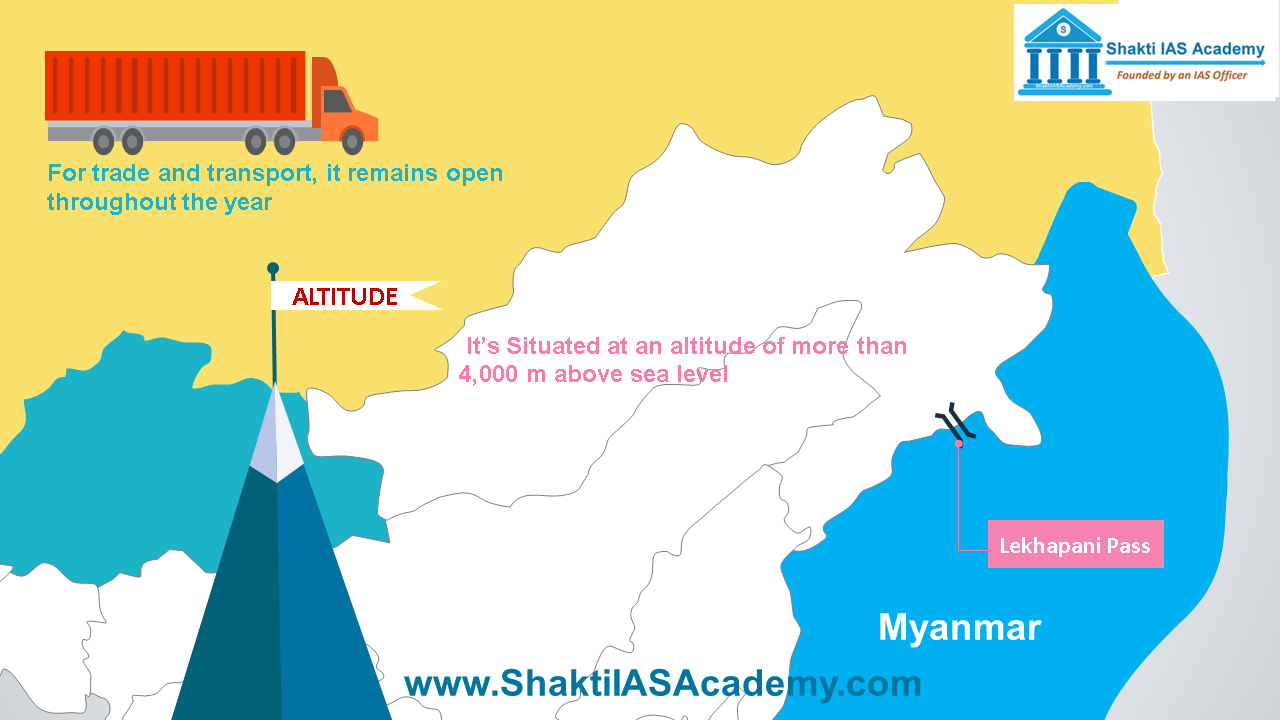 Lekhapani Pass Lekhapani Pass Situated at an altitude of more than 4,000 m above sea level, the Lekhapani Pass joins Arunachal Pradesh with Myanmar. For trade and transport, it remains open throughout the year. Comments are closed.
|
